Welcome to the Encyclopedia of Saskatchewan. For assistance in exploring this site, please click here.
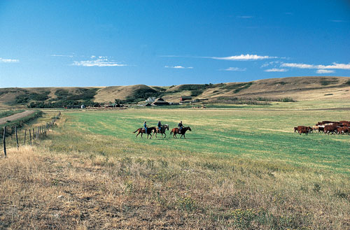
(49°40’N, 109°30’W: map sheet 72 F/11). The Cypress Hills are located in the southwestern corner of Saskatchewan, where elevations rise more than 600 m above the surrounding plains over a distance of less than 50 km. This historic landscape consists of three “blocks” spanning an area of about 2,500 km2 between Eastend in Saskatchewan and the “head of mountain” west of Elkwater, Alberta. The East Block is rangeland and home to the Nekaneet First Nation. Most of the Centre and East Blocks are within the boundaries of Cypress Hills Interprovincial Park. They are separated by “the Gap,” an area of hummocky moraine and native mixed grassland. Westward, the Cypress Hills become higher and more rugged. The West Block, straddling the Alberta-Saskatchewan boundary, rises to the highest elevation in Saskatchewan (1,392 m); in Alberta it reaches 1,466 m, the highest point in Canada from the Rocky Mountains to Labrador and the Appalachians. The Cypress Hills were created from the floor of a broad river valley. Sands and gravels transported by rivers from the Rocky Mountains now cap this elevated plateau. The topography was reversed as the rivers of the late Tertiary period gradually removed layers of rock, lowering the northern Great Plains to its present level. A few erosional remnants survived as flat-topped uplands or plateaux. The Cypress Hills survived, mostly because of their location midway between the South Saskatchewan and Missouri rivers. They now form a continental drainage divide between these two major river systems. During the Pleistocene glaciation, the Laurentide ice sheet was unable to flow over this prominent upland. Consequently, about 300 km2 of the West Block was probably a nunatak or island in the ice. Meltwater, trapped between the uplands and the ice sheet, flowed through and around the Cypress Hills, eroding large glacial meltwater valleys. “Underfit” streams such as Battle Creek and the Frenchman River now occupy these valleys. The large valleys and incised tributary valleys remain active, with slumping of the valley sides and shifting of the streams during floods.
Because of their higher elevation, the Cypress Hills are cooler and wetter than the adjacent plains. The local climate varies with changing aspect. This influences vegetation, which ranges from dry grassland to humid forested slopes. Mixed grassland, native to the surrounding plains, occurs at lower elevations and on dry south-facing slopes in the Cypress Hills. John Palliser described the Hills as “a perfect oasis in the desert.” Wetlands are common: there are numerous springs and ponds, especially in the hummocky terrain of the Landslides. White spruce forest grows in the cool, moist conditions near springs and on north-facing slopes. Balsam poplar and trembling aspen can occur at these sites, but also as groves on the plateaux or along moist creek beds extending out onto the prairie. Lodgepole pine grows in the drier areas and above the other Forests, while fescue prairie is found at the highest elevations. Fescue grassland and the lodgepole pine forest are considered montane vegetation; the closest similar plant communities are in the Rocky Mountain foothills. This disjunct flora of the Cypress Hills includes many plants that are rare in Saskatchewan, and several, such as orchid species, that are rare in general. This island forest in the midst of grasslands is sensitive to human activities and to small perturbations in Climate. It has been highly valued for economic, cultural, spiritual, and environmental reasons. The woodlands are habitat for a large variety of birds including the hairy woodpecker, great horned owl, ruffed grouse, mountain bluebird, yellow-breasted chat, Turkey Vulture and wild turkey. They also provide shelter for red squirrels, porcupines, chipmunks, deer, elk, moose, bobcats, and the occasional lynx.
Artifacts from archaeological sites in the Cypress Hills represent more than 7,000 years of human history. Accounts of European contact with Aboriginal people suggest that the Hills were a buffer zone among the various tribes who followed bison and elk as they retreated to the woods during winter months. The name Cypress Hills originated with Métis settlers of the early 19th century, who mistook the lodgepole pine for jack pine, or cyprès in French. The next wave of settlers, primarily from the United States and eastern Canada, settled in the Cypress Hills region starting in the 1880s; they established the Ranching industry that has dominated the Land Use ever since. A historical event of national significance was the Cypress Hills Massacre of 1873, when over twenty deaths resulted from a disagreement between American wolfers and a group of Assiniboine (Nakota) over lost horses. When news of the massacre reached Ottawa, the government of Sir John A. Macdonald established the North-West Mounted Police (NWMP). The following year, the (NWMP) established Fort Walsh on Battle Creek; this site is now a popular national historic site.
David Sauchyn
Print EntryHOME | BROWSE BY SUBJECT | ENTRY LIST (A-Z) | IMAGE INDEX | CONTRIBUTOR INDEX | ABOUT THE ENCYCLOPEDIA | SPONSORS TERMS OF USE | COPYRIGHT © 2006 CANADIAN PLAINS RESEARCH CENTER, UNIVERSITY OF REGINA | POWERED BY MERCURY CMS |
|||
| This web site was produced with financial assistance provided by Western Economic Diversification Canada and the Government of Saskatchewan. |
|||
| Ce site Web a été conçu grâce à l'aide financière de Diversification de l'économie de l'Ouest Canada et le gouvernement de la Saskatchewan. |
|||